History of the Neighborhood
Portions of Clifton Heights are among the earliest developed areas in southwest St. Louis. Moreover, there is a more varied topography throughout the neighborhood than in adjoining areas to the east and south. Relative to most of the City of St. Louis, there are noteworthy hills and prominent natural valleys. This combination of natural topography and history gives much of Clifton Heights a look and feel that distinguishes it from elsewhere in St. Louis.
The entire area covers a large hill that naturally slopes north and west toward the ancient valley of the River Des Peres, long since channelized, and shared by the Burlington Northern & Santa Fe Railway and I-44. On this hill is a natural “dimple” or mini-valley. This bowl is the setting for Clifton Park and its small lake. It is surrounded by substantial homes to form the area’s focal point. There are also slopes east toward Hampton, as well as along Watson, on either side of Arsenal. Hampton itself dips around Watson.
This vicinity was included in the early colonial land grants. There was some agricultural use of the area both prior and subsequent to the extension of the then Pacific Railroad line along the River Des Peres during the 1850s. The old Frisco Railway added its tracks in the 1880s. Gradually, industrial uses gravitated to sites along the railroads and the River Des Peres during this period.
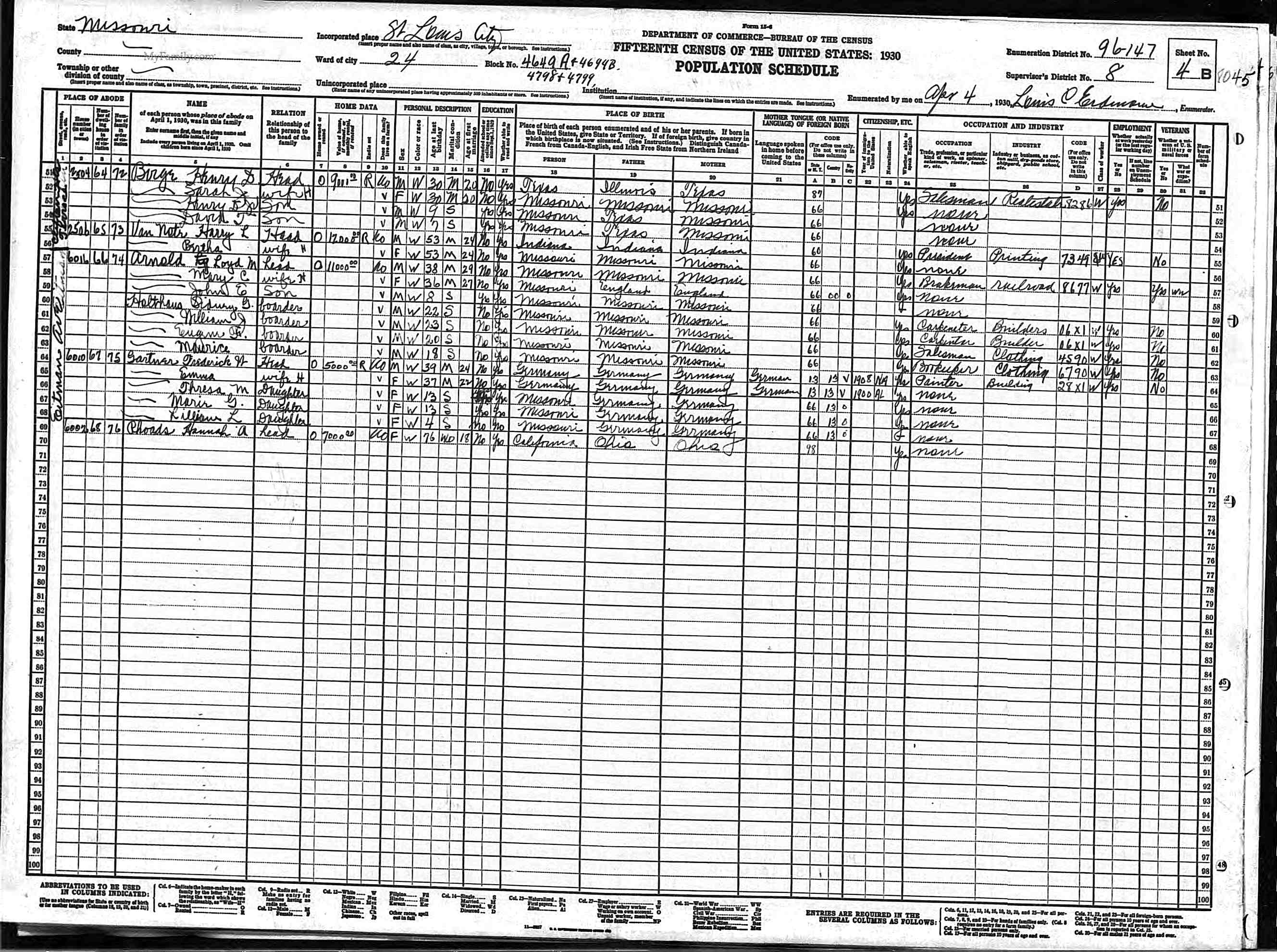
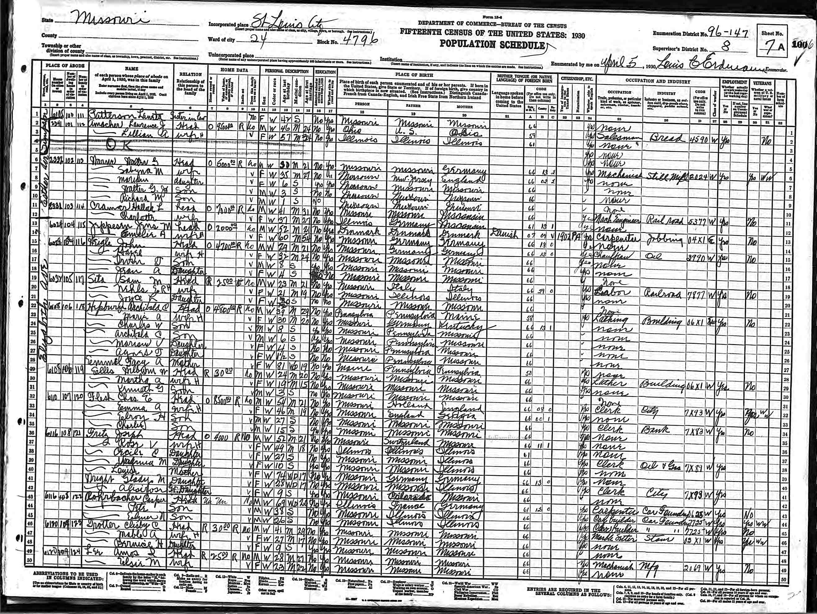
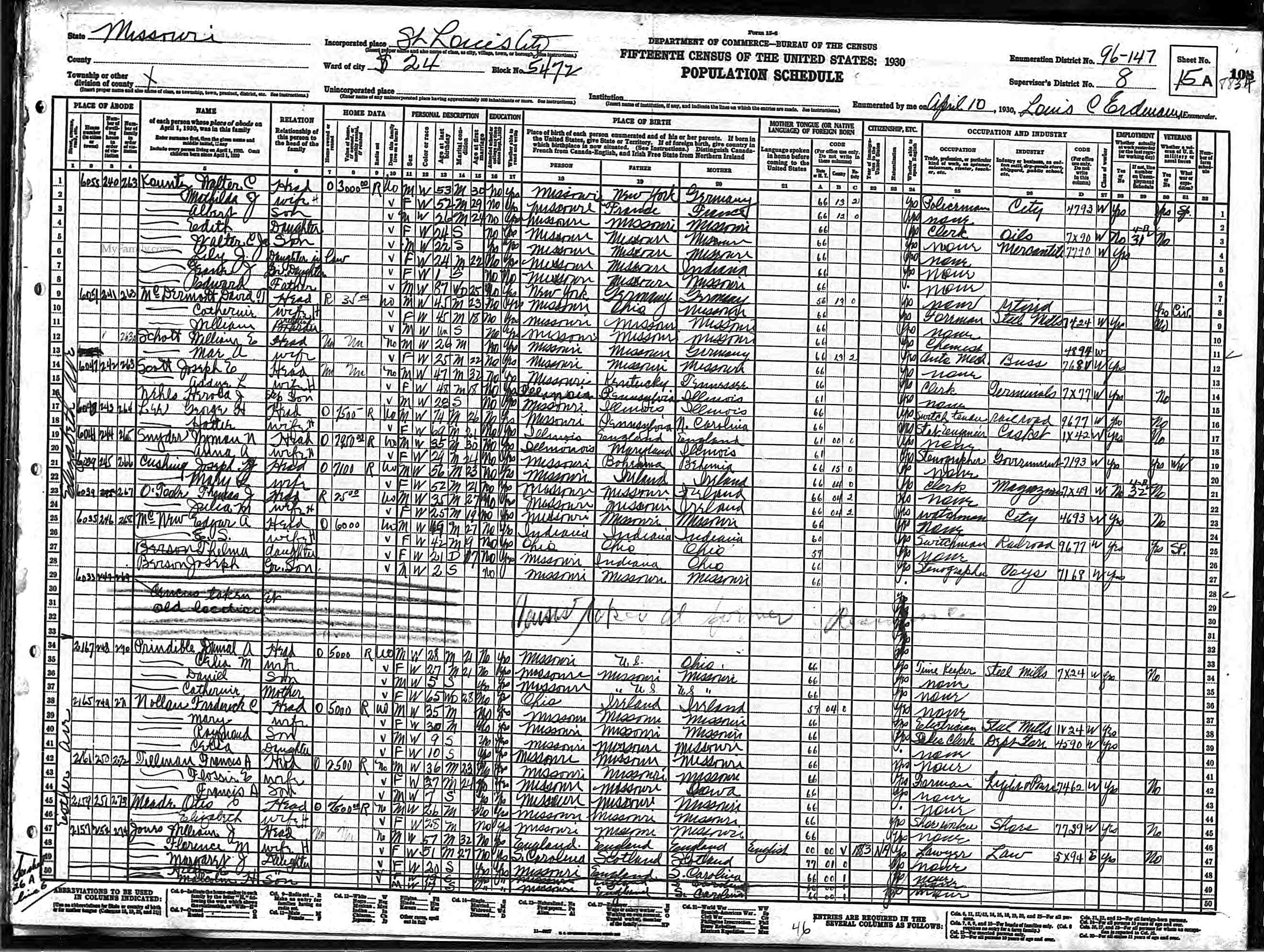
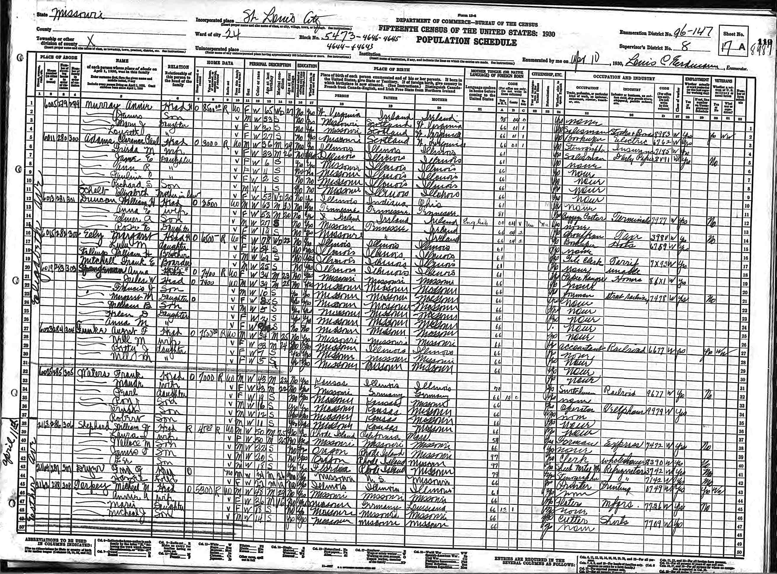
Historical Census Data
Below are some sample hand-written census sheets from the US Census of 1930 (click to enlarge):

References
City of St. Louis, MO (n.d.). Clifton Heights Neighborhood Overview. City of St. Louis, MO: Official Website. Retrieved March 25, 2025, from https://www.stlouis-mo.gov/live-work/community/neighborhoods/clifton-heights/clifton-heights-overview.cfm
